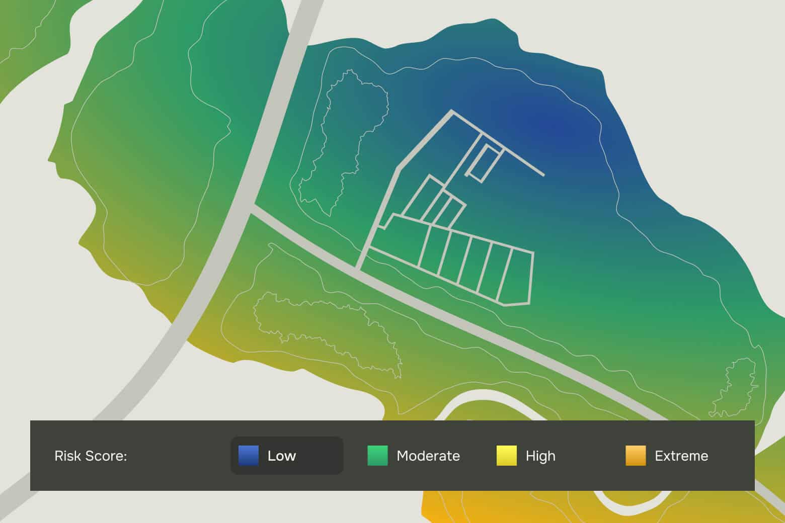
Covering a wide range of perils including inland flood, tropical cyclone wind, storm surge, severe convective storm, wildfire, and earthquake, Hazard Data provides insights into location-level risk with detailed return period values and risk scores.
01
Comprehensive
Return period hazard values and risk scores included.
02
Ultra-high resolution
Industry-leading resolution without sacrificing reliability.
03
Climate change-integrated
Our climate change data layers empower users to understand changes in future risk due to the impact of climate change.
“We have been partnering with KatRisk, licensing their US/Canada flood models for the past few years, and couldn’t be more satisfied. KatRisk consistently provides reliable models that have significantly enhanced our risk assessment processes for our clients. The quality and robustness of their models enable more informed decisions and better client service. KatRisk’s commitment to innovation and excellence is evident in every interaction. Their support is prompt, professional, and always goes the extra mile to meet our needs.”
“As former clients, we’ve consistently had positive experiences with KatRisk, the market leader in flood modeling. Now that our team has grown and our product offerings have matured, the timing is perfect to return and collaborate with such a trusted partner. We are excited to leverage this partnership to enhance our capabilities and strengthen our market presence.”
“As our first modeling partner, KatRisk has been instrumental to our success at EigenRisk. Their innovative approach to catastrophe risk modeling significantly enhances our ability to offer clients detailed, forward-looking insights. The precision and reliability of KatRisk’s models, particularly when it comes to integrated flood, wind, and surge risk, enable us to provide unparalleled analytical capabilities. We value this relationship because it empowers our clients to make informed, data-driven decisions, bolstering their resilience against the most challenging natural disasters.”
“At FloodFlash, our parametric insurance model revolutionizes flood risk management by triggering payouts based on predetermined flood depths detected at each property. Our unique, sensor-based approach is powered by KatRisk’s high-resolution, peril-specific models, which provide the critical data we need to apply our own risk pricing methodology effectively. KatRisk’s precise flood modeling enhances the accuracy, affordability, and accessibility of our offerings. By leveraging KatRisk’s detailed understanding of flood dynamics, we can tailor our insurance products and offer substantial support to clients regarding sensor placement, trigger depths, and payouts. This integration improves the customer experience and broadens the reach of our parametric insurance, making it an essential tool for those traditionally underserved by the insurance market.”
“The Neptune team is delighted to renew our longstanding partnership with KatRisk. Operating at the cutting-edge of data and actuarial science is a pillar of the underwriting philosophy at Neptune. Integrating industry-leading analytics like KatRisk’s stochastic flood model into our ML engines strengthens our ability to respond to the challenges of climate change. KatRisk’s advanced API supports real-time data integration into our underwriting models, facilitating over 25,000 quotes daily via our Triton platform, and ensuring a smooth and efficient policy purchase process.”
Access unparalleled reliability and accuracy
Speak to our team to see how Hazard Data can help you assess climate-related risk with more confidence.